13 – Bouches-du-Rhone

13 – Bouches-du-Rhone

Bouches-du-Rhône is defined by strong contrasts, from the wetlands and lagoons of the Camargue to the semi-steppe plains of the Crau and the limestone massifs of the Alpilles and Calanques. These landscapes support a distinctive mix of wetland, steppe and Mediterranean species, making the department one of the most ecologically important lowland areas in southern France.
Wild Places

These are listed by order of importance, National, Regional Parks, Reserves and local hotspots that should be of interest to all nature lovers, whether serious listers or casual observers.

Waiting To Be Discovered Are:
calanques national park

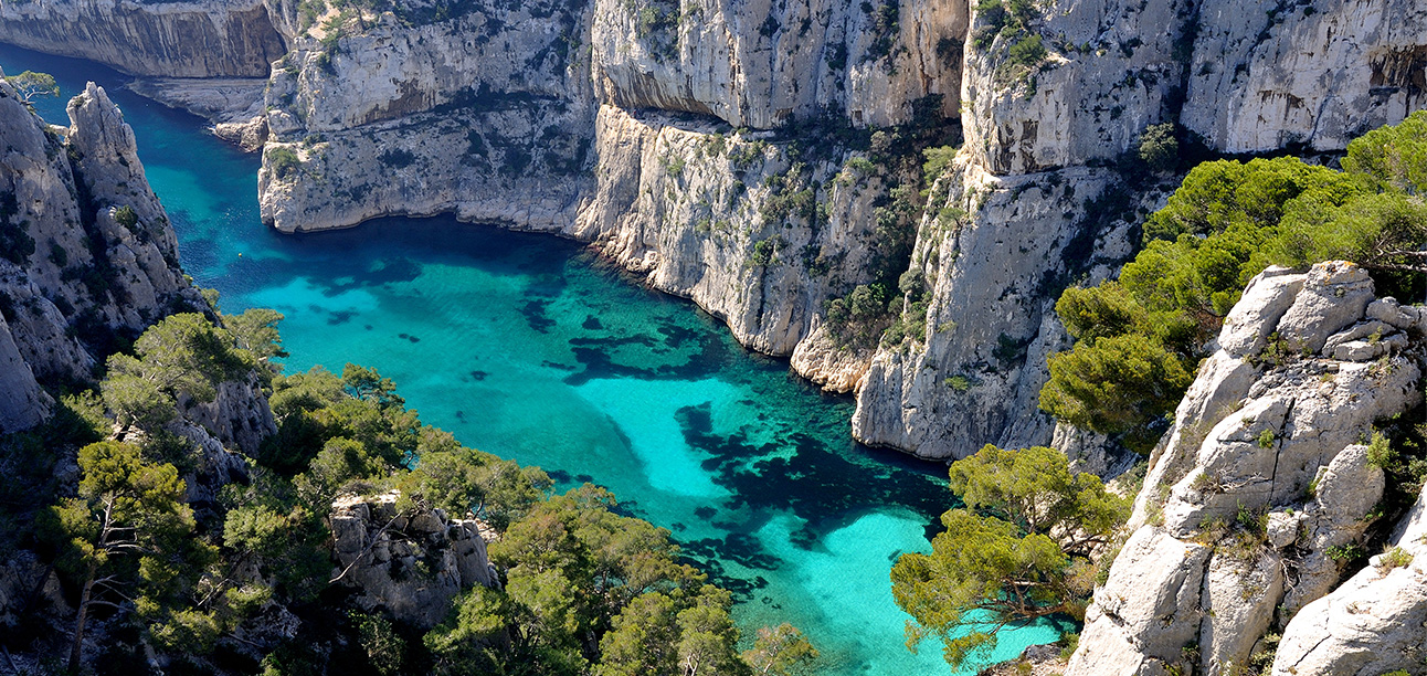
Calanques National Park

Recognised as an international biodiversity hotspot, the Calanques are home to some of the world’s most outstanding flora and fauna, as well as a remarkable cultural heritage, a testimony to its rich history.

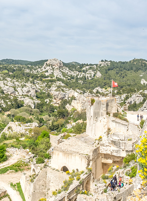
The Alpilles Regional Park

A limestone massif of low hills, valleys and plateaus characterised by garrigue, olive groves and open farmland. The Alpilles support one of the richest assemblages of Mediterranean birds in France, including several nationally rare breeding species.

A limestone massif of low hills, valleys and plateaus characterised by garrigue, olive groves and open farmland. The Alpilles support one of the richest assemblages of Mediterranean birds in France, including several nationally rare breeding species.

The Camargue Regional Park

One of Europe’s most famous wetland landscapes. The Camargue is defined by lagoons, reedbeds, salt marshes and extensive grazing land, supporting enormous numbers of resident and migratory birds.
Over 400 bird species have been recorded here, making it one of the most important birding areas in Western Europe.
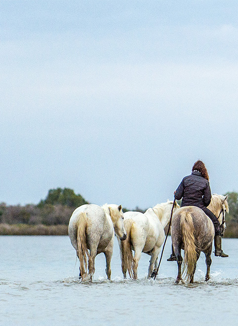
One of Europe’s most famous wetland landscapes. The Camargue is defined by lagoons, reedbeds, salt marshes and extensive grazing land, supporting enormous numbers of resident and migratory birds.
Over 400 bird species have been recorded here, making it one of the most important birding areas in Western Europe.
Sainte-Baume Regional Park

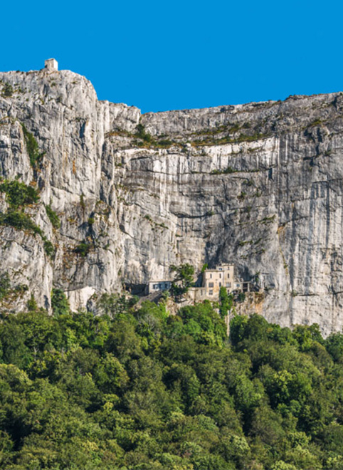
Steeped in folklore as the final resting place of Mary Magdalene. This holy land is also home to some lesser known inhabitants.

Steeped in folklore as the final resting place of Mary Magdalene. This holy land is also home to some lesser known inhabitants.

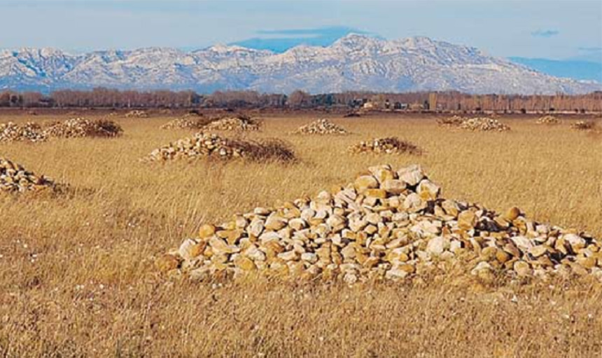
The Coussouls de la Crau National Nature Reserve protects one of the most unusual and irreplaceable landscapes in Europe. Situated between the Alpilles and the Rhône delta, the Crau is not grassland, scrub or farmland. It is the last surviving Mediterranean steppe in Western Europe, a landscape whose origins predate most modern ecosystems in France.

RNN – Coussouls de la Crau

The last true steppe habitat in Western Europe. An ancient stony plain shaped by the former Durance delta, supporting highly specialised species adapted to open, arid conditions. One of France’s most important sites for steppe birds and invertebrates.

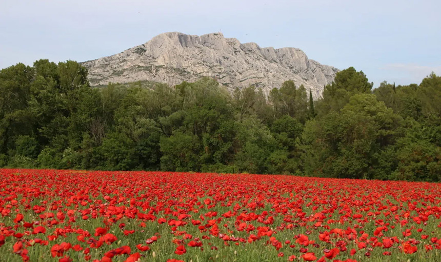
Sainte-Victoire offers a concentrated overview of Mediterranean biodiversity: from open garrigue and dry grasslands to cliffs, woodlands, and cultivated fringes. It is a site that rewards both casual exploration and focused biological recording.
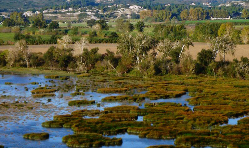
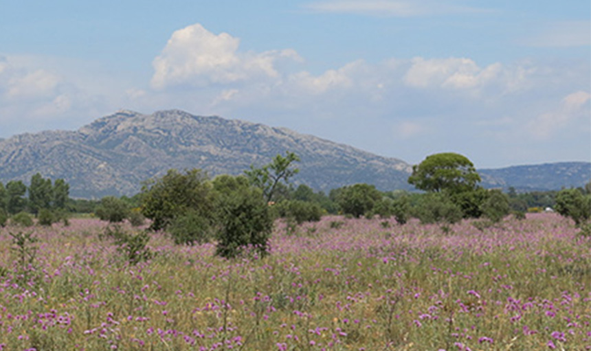
RNN – Mont Saint-Victoire

For visitors exploring Provence by department and protected site, Sainte-Victoire offers a concentrated overview of Mediterranean biodiversity: from open garrigue and dry grasslands to cliffs, woodlands, and cultivated fringes. It is a site that rewards both casual exploration and focused biological recording.
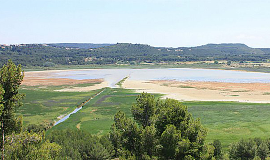
The site is home to several animal species of great heritage interest: Eurasian bittern, European roller, European pond turtle.

RNR – L’Ilon

The site is home to several animal species of great heritage interest: Eurasian bittern, European roller, European pond turtle.

The Poitevine is another fragmented arid grassland, punctuated with old almond and olive trees. The site hosts large populations of little bustards and nesting stone curlews.

RNR – Poitevine-Regarde-Venir

The Poitevine is another fragmented arid grassland, punctuated with old almond and olive trees. The site hosts large populations of little bustards and nesting stone curlews.

The Etang du Pourra is a vast wetland of around 160 hectares made up of a mosaic of natural habitats that are attractive to Mediterranean fauna.

RNR – Pourra – Domaine du Ranquet

The Etang du Pourra is a vast wetland of around 160 hectares made up of a mosaic of natural habitats that are attractive to Mediterranean fauna.

Restricted access and paid entry reserves

There are two further RNR’s that warrant inclusion but they either have restricted access or require paid entry to access these locations.

Research-led wetland management (limited access)

Tour du Valat is not a conventional visitor site. It is one of the most important wetland research centres in the Mediterranean, where access is deliberately limited to protect both ongoing scientific work and sensitive habitats.

The landscape is a carefully managed mosaic of freshwater and brackish marshes, reedbeds, seasonally flooded grasslands and shallow lagoons. Water levels are actively controlled to mirror natural hydrological cycles, creating optimal conditions for breeding, wintering and migratory species.

This approach has made Tour du Valat a reference site for wetland conservation across Europe and the Mediterranean. It supports exceptional concentrations of colonial waterbirds, including herons, egrets, spoonbills and flamingos, as well as key species such as Ferruginous Duck, Glossy Ibis and Marsh Harrier. Amphibians, dragonflies and aquatic plants also benefit from the long-term stability of management.

Restricted access is essential here. Disturbance would compromise both research outcomes and the fragile balance that allows wildlife to thrive. Tour du Valat exists first and foremost as a working wetland, quietly shaping conservation far beyond the Camargue.

Immersive wetlands with managed public access (paid entry)

The Marais du Vigueirat offers one of the most complete wetland experiences in the Camargue, while maintaining strict control over visitor numbers. Paid entry directly supports habitat management and ensures that people can explore without overwhelming the ecosystem.

The site encompasses a rich gradient of environments: freshwater marshes, reedbeds, wet meadows, riparian woodland and temporary pools. Seasonal flooding and grazing create constantly shifting conditions, meaning wildlife presence changes throughout the year.

This diversity supports a remarkable range of species. Visitors may encounter Purple Heron, Little Bittern, Glossy Ibis, Bearded Reedling, Bluethroat and large numbers of wintering ducks and waders. The wetlands are also important for amphibians, dragonflies and a wide variety of wetland plants, making the site as rewarding for botanists and entomologists as it is for birders.

Access is channelled along boardwalks and trails to protect breeding areas and reduce disturbance. The result is a rare balance: a wetland that remains ecologically functional while allowing people to slow down, observe, and genuinely understand why these landscapes are protected.

Additional Wildlife Hotspots

These sites fall outside formal protected area boundaries but are widely recognised for their ecological significance.

Rocky Mediterranean islands with cliffs, scrub and surrounding marine waters.

Why this site matters:
These islands support breeding seabirds, migratory stopovers and marine-influenced terrestrial communities largely absent from the mainland. Their isolation and exposure make them ecologically distinct despite proximity to Marseille.

Species of interest:
Breeding seabirds · migratory passerines · marine invertebrates

Dry limestone ridge and plateau north of Marseille with open scrub, rocky slopes and woodland edges.

Why this site matters:
A major ecological block outside formal protection, forming an inland counterpoint to the Calanques. Its elevation and exposure support raptors, scrub birds and Mediterranean flora, while acting as a movement corridor between coastal and inland systems.

Species of interest:
Raptors · Mediterranean scrub birds · calcicole flora

Large freshwater reservoir set within garrigue near Aix-en-Provence.

Why this site matters:
One of the most significant inland freshwater bodies outside protected wetlands, offering winter refuge and passage habitat in a dry limestone landscape.

Species of interest:
Wintering ducks · grebes · gull assemblages

Freshwater wetland on the Bouches-du-Rhône side of the Durance floodplain, comprising open water, reedbeds and marshy margins.

Why this site matters:
A discrete wetland feature within an otherwise heavily managed river system, providing refuge and stopover habitat for wetland birds and supporting amphibians and aquatic invertebrates.

Species of interest:
Reedbed birds · wetland waterbirds · amphibians

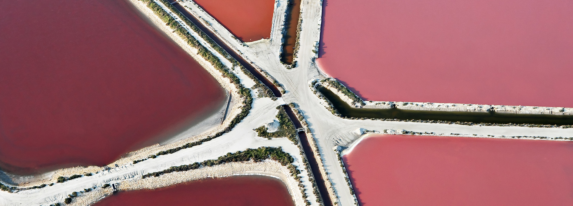
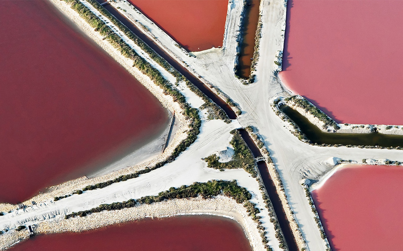
Fragmented lagoons, saltmarsh remnants and industrial margins around the Berre basin.

Why this site matters:
Despite heavy modification, peripheral habitats remain important for wintering and passage waterbirds, particularly during cold spells or regional disturbance.

Species of interest:
Wintering waterbirds · passage waders

Field Calendar and Seasonal Dynamics

Spring (March to May) and Autumn (September to October) represent the peak operational windows for land-based naturalists in the Bouches-du-Rhône. These windows avoid severe weather extremes and capture maximum avian migration across the coastal headlands, salt pans and interior limestone ridges. Route mapping can be optimised across the Alpilles and local wetland zones using the Chemins des Parcs regional network tool or the MyProvence Balades primary infrastructure registry for public paths.

Winter (November to February) shifts the biological focus towards resevoirs, lagoons and coastal wetlands, which support globally significant assemblages of wintering wildfowl, passerines, raptors and gulls.

Summer Field Access and Fire Risk Regulations (DFCI)

Between 1 June and 30 September, human presence within the forest massifs of the Bouches-du-Rhône is strictly regulated by prefectural decree to mitigate the high risk of wildfires. The dry, highly flammable vegetation profiles of the garrigue and maquis combined with intense Mistral wind events can accelerate a localised ignition into a major canopy fire in under an hour.

Field access decisions are calculated daily by Météo-France, the National Forestry Office (ONF) and the fire services. The official colour-coded risk map is published every evening at approximately 18:00 (6:00 PM), dictating access permissions for the entire following calendar day.
Green or Yellow codes permit standard vehicular and pedestrian transit.
Orange codes permit access but strongly discourage entry into dense massifs.
Red codes permanently prohibit all public access to trails, dirt tracks and massifs all day, including coastal land paths and maritime vessel landings within the Calanques.
Black codes enforce absolute zero-access closures across all ecosystems due to exceptional structural hazard warnings.

Naturalists plotting field excursions must verify status nightly after 18:00 via the official Bouches-du-Rhône Prefecture Access Map or the real-time FOSIVA Regional Dashboard to check boundary limits. Regardless of the daily code, lighting fires, smoking, wilderness camping (camping sauvage) and driving motorised vehicles onto dirt tracks marked with a B0 sign are permanently illegal within and up to 200 metres from all forest perimeters.

Field Notes & Responsible Practice

Please refer to our code of conduct page for responsible recording and observation.